

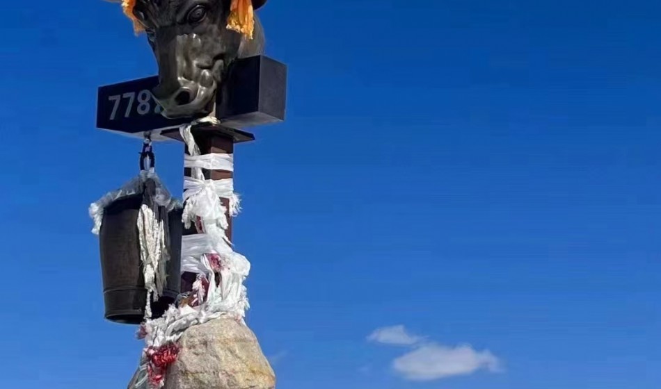
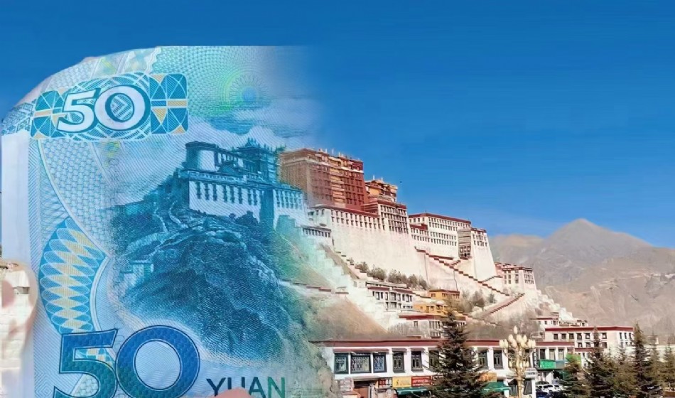
Shenshan Shenghu+Zhuanshan 15 days 14 nights
- /img/151067.jpg
- /img/1510739.jpg
- /img/1510724.jpg
- /img/1510850.jpg
- /img/1510940.jpg
- /img/15101056.jpg
Detailed itinerary
Arrival in Lhasa - airport/station pick-up - hotel check-in
Tourists can choose flights recommended by travel agencies and purchase their own tickets to travel to Lhasa, where they will gather on the same day. The tour guide and driver will welcome tourists at Lhasa Airport, and then take a ride along the Lhasa River scenic belt to the city center of Lhasa to experience the pure air of the plateau. After arriving in Lhasa, please stay at the hotel booked by the travel agency and try to avoid going out as much as possible. Rest well to adapt to altitude sickness. Tourists in good physical condition can visit the night view of the Potala Palace at night.
Lhasa City: Potala Palace, Jokhang Temple, Barkhor Street
In the morning, visit the Potala Palace, the world's highest ancient castle style building complex. It is the residence of all previous Dalai Lamas and the center of political and religious power in Xizang. There are golden stupas storing the true bodies of all previous Dalai Lamas, as well as a large number of precious murals, Thangkas, and Buddha statues, which are the concentrated embodiment of Tibetan culture. After lunch, visit the earliest Buddhist temple built during the Tubo Dynasty - Jokhang Temple. The temple houses a 12-year-old statue of Shakyamuni Buddha, who accompanied Princess Wencheng to Tibet. This is the most sacred and spiritual Buddha statue in the hearts of the Tibetan people. Here, tourists can not only see the devout worship of the people, but also follow them around the Barkhor Street to pray for sentient beings.
Lhasa - Yangzhuoyongcuo - Karula Glacier - Shigatse
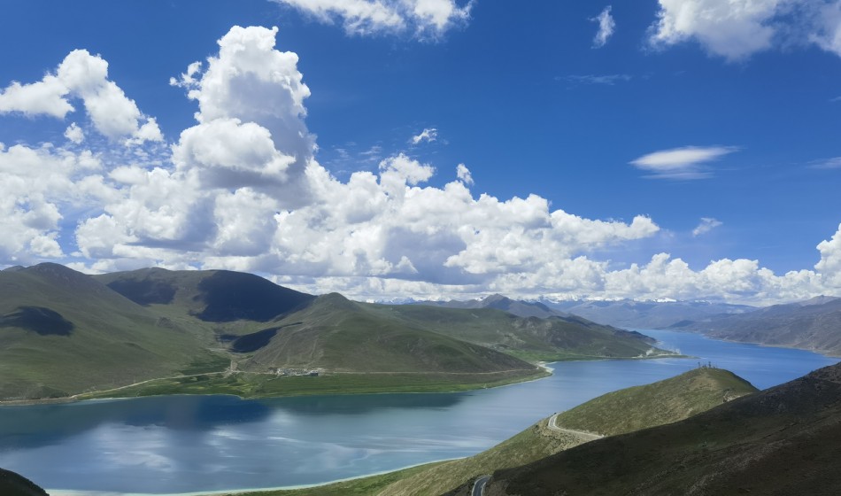
Depart from Lhasa in the morning and drive to Yangzhuoyongcuo, one of the three holy lakes in Xizang with colorful and changeable colors. Yanghu Lake is the highest freshwater lake in the world, with an elevation of 4441 meters above sea level, meaning "Jade Lake" in Tibetan. After descending the mountain, I had a close encounter with Yangzhuoyongcuo, where the deep blue lake water merged with the distant snow capped mountains. Along with the colorful mountains on both sides, the distinctive Tibetan villages, and the abundance of cattle and sheep, the journey was truly delightful.
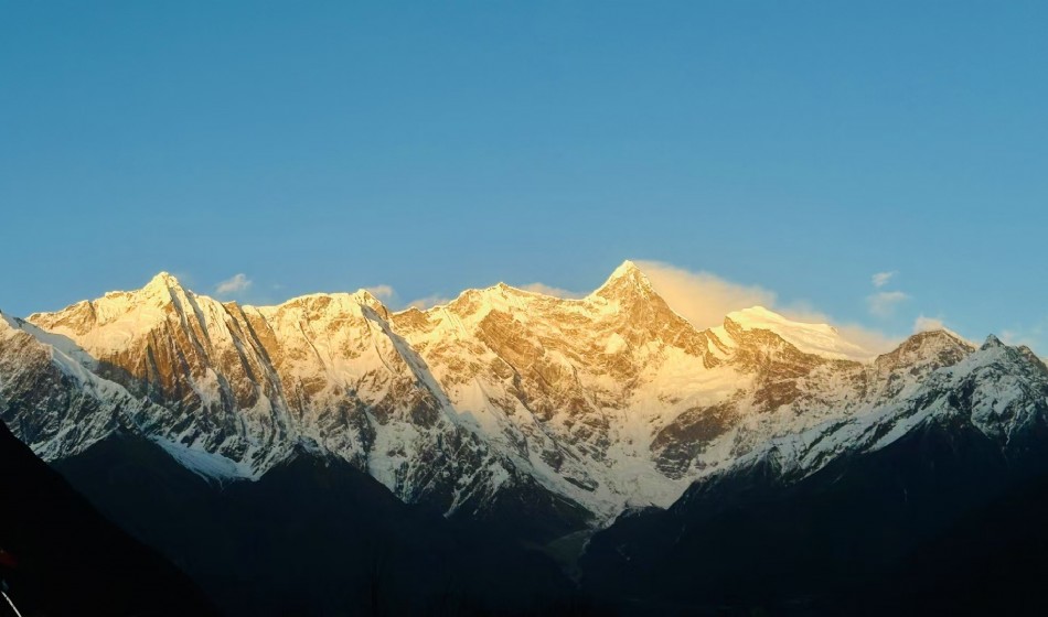
In the afternoon, pass by and observe the Karura Glacier from afar, feeling its majestic and spectacular scenery, misty clouds, and unparalleled beauty. Glaciers are geological histories written by flowing years and ice and snow, and great works of art carved by time. Afterwards, move in to Shigatse.
Shigatse - Dingri - Mount Everest Base Camp - Basong Village
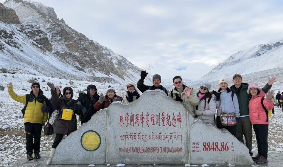
In the morning, take a bus through Lazi to reach Xiegeer, the county seat of Xindingri. Along the way, we will climb over the 5220 meter high Jiacuola Snow Mountain, and when we are about to reach Xiegeer, we can overlook the majestic appearance of Mount Everest. Afterwards, make a brief stop and head to Dingri. In the afternoon, arrive at the world's highest altitude Mount Everest Nature Reserve. Located at the highest altitude temple in the world - Rongbuk Temple (5100 meters above sea level), facing south, it is universally recognized as the best location to admire Mount Everest. Here, white pagodas stand tall and colorful prayer flags dance. Take an eco-friendly car to reach the base camp of Mount Everest at an altitude of 5200 meters, where you embrace the world's highest peak, Mount Everest.
Basong Village - Dingri - Xixiabangma Nature Reserve - Pekucuo - Sagar
After enjoying breakfast, continue moving forward with nostalgia for Mount Everest and admire the scenery surrounded by mountains. On the way, we passed the plateau lake [Pekutso] at the roadside, looked at the [Xixia Bangma Peak] (in Tibetan, "Xixia Bangma" means "harsh climate", formerly known as the monk Zan Peak, located in Nyalam County, Xizang Autonomous Region) at an altitude of 8013 meters, and entered the vast no man's land of [Saga]. Sagar is located in the northwest of Shigatse region, with a border line of 105 kilometers. The 219 National Highway runs through the entire area, leading east to Shigatse and Lhasa, west to Ali, Pulan and other places, and south to Jilong County and the Kingdom of Nepal. Saga is located in the north foot of the the Himalayas and the southwest edge of the Gangdise Mountains to the south. It is located in the upper reaches of the the Yarlung Zangbo River. There are sacred mountains, holy lakes, vast grasslands, yaks and other plateau scenery in the territory. The average altitude of the county is over 4600 meters, which belongs to a typical continental plateau climate. It is extremely cold and harsh, with long winters and short summers, thin air, abundant sunshine, and large temperature differences between day and night.
Saga Zhongba Maquan River Wetland Park Tarqin
After breakfast, proceed along National Highway 219 and pass by the town of 'Bayang', which is under the jurisdiction of Zhongba County. This is a small town with a strong Western style, and it is also the highest town in the world at an altitude of 4700 meters. Along the way, enjoy the scenery of the Maquan River basin, gradually enter the embrace of the sacred mountain "Gangren Boqi" and the holy lake "Mapan Yongcuo", and head to the ghost lake "Laongcuo", where you will stay overnight in Tarqin.
First day of mountain rotation: Tarqin Zhire Temple
In the early morning, I took an eco-friendly bus from Tarqin, went deep into the valley, and prepared to hike to the mountains. There are yaks and horses to experience in the valley, and there are also luggage handlers to provide convenience for guests carrying large luggage. (Reminder: The tour fee does not include horse riding, yak riding, and luggage handling fees.) Adjust your breathing, position yourself, and measure this pure land with both feet. Ascending along the valley, accompanied by blue skies and snow capped mountains, occasionally a river meanders through, providing the most authentic experience of nature's incredible craftsmanship. Along the way, you can also see the west and north sides of Mount Kailash, with one side towering into the clouds and the other side layered and continuous. On the journey, I encountered this mountain peak in a wonderful way, tasted its diverse and unique perspectives, and deeply experienced its charm. After about 22 kilometers of mountain trekking, we arrived at Zhire Temple and rested and fell asleep amidst the colorful fluttering prayer flags, filled with devotion to faith and reverence for nature.
Second day of mountain rotation: Zhire Temple - Zuchu Temple
After a night of rest and replenishing energy, we began a new day of hiking. Today, we will cross the highest altitude point of this mountain pass - the Zhuomala Pass (5630 meters). Along the way, you will coincidentally encounter many devout Tibetan people bowing down and worshipping. The snow covered road is somewhat slippery, and the rolling gravel in the valley makes a sizzling sound, making it difficult to walk. The so-called "Zhuanshan Road" is actually the little traces of the Tibetan people's bodies and feet stepping on the path to holiness between ice, snow, and gravel, which is the accumulation of time. Walking on the sacred path may be a bit difficult, but it is advisable to take a break at the tea houses along the way and adjust your energy. In the gentle breeze, various prayer flags dance at the Zhuomala Mountain Pass, and below the valley lies a beautiful small sea called Tuojicuo. It is a compassionate lake, like a transparent white jade embedded among the towering mountains. After passing through the Zhuomala Mountain Pass, starting downhill will significantly reduce physical exertion. Turn around the mountain and hike back, then spend the night at the Zuchu Temple Guesthouse.
Third day of mountain rotation: Zuchu Temple - Talqin
On the third day of the mountain rotation, as the altitude decreased, the surrounding color gradually changed from snow-white to emerald green, and small animals among the shrubs began to become active, full of a strong sense of life. Stacks of Mani stones are colorful and stacked among the snow capped mountains and grasslands, like monks who are devoted to prayer. After completing the last 10 kilometers of hiking, it was noon when our tour bus welcomed friends who had completed the mountain turn here, and then drove to Tarqin to check in.
Talqin Laongcuo Zhongba Saga
After breakfast, head to Laongcuo. To its west, there is a lake shaped like a beautiful crescent moon, with a deep blue lake water, and the shape of Mapanyongcuo is like the sun. Their original shape exudes a harmony, an ultimate realm of diamond beauty. Afterwards, heading towards Lhasa, one is greeted by the unique plateau scenery of ice peaks, snow ridges, and cliffs along the way. Its enchanting charm attracts countless explorers to conquer, experience, and appreciate it. On the way, Tibetan children showed bright smiles like the sunshine on the plateau, and their pure eyes were like clear blue skies. This is the day when we are closest to the sky. Sagar is located in the northwest of Shigatse region, with a border line of 105 kilometers. The 219 National Highway runs through the entire area, leading east to Shigatse and Lhasa, west to Ali, Pulan and other places, and south to Jilong County and the Kingdom of Nepal. Saga is located in the north foot of the the Himalayas and the southwest edge of the Gangdise Mountains to the south. It is located in the upper reaches of the the Yarlung Zangbo River. There are sacred mountains, holy lakes, vast grasslands, yaks and other plateau scenery in the territory. The average altitude of the county is over 4600 meters, which belongs to a typical continental plateau climate. It is extremely cold and harsh, with long winters and short summers, thin air, abundant sunshine, and large temperature differences between day and night.
Sagar Dagjia Fountain (World Hot Spring Wonder) - Dajiacuo - Garongcuo - Parucuo - Cuoqin
After breakfast, follow the 219 National Highway and pass by the Dagjia Fountain in Chere Township, Angren County. From a distance, the fountain mouth looks like a huge "pressure cooker", with layers of mist emanating outwards and drifting towards the clouds with the airflow. When a fountain erupts, there will be phenomena such as boiling hot water, gas holes, and hot water explosions, which are very spectacular. On the plateau, the boiling point of water is about 85 ℃, while the spring water of the Dagger Fountain has a boiling point as high as 100 ℃, which can cook raw eggs in less than 10 minutes.
Later, passing by the mountainous basin of Dajiacuo, the basin is surrounded by high mountains with an altitude of over 5200 meters, and some mountaintops are covered in snow all year round. Under the snow capped mountains, there are herds of animals and picturesque scenery in Dajiacuo.
When driving on the plateau away from Dajiacuo, one can see a scene of rain in the east and sunshine in the west. After passing through Garongcuo and Parucuo, there are many waterbirds here, as well as Meiduo Village and the lake behind the village. A small river flows into the distance, and in the distance is Cuoqin.
Cuoqin Zharinanmu Cuo Dangjiayong Cuo Wenbunan Village Wenbunbei Village Dangqiancuo Nima
After breakfast, heading from Cuoqin County to Zarinan Mucuo, groups of wild animals such as Tibetan wild donkeys and Tibetan antelopes can often be seen along the way. Passing through Dangye Yongcuo, we arrived at Wenbunan Village, which has an altitude of only 4600 meters and seems like a place to enter "relaxed mode". This village has a unique feature, as the villagers do not believe in Tibetan Buddhism, but in Bon religion. In Xizang, there are few people who believe in Bon. The village is located next to the holy lake of Dangye Yongcuo, and living by this holy lake is truly a happy thing. Dangqiancuo and Dangjiayongcuo used to be the same large lake, but later they were divided into two due to climate change and a decrease in water level. Beside the lake is another ancient village - Wenbubei Village. After a short stay in Wenbu North Village, we left for NATO and arrived at Nima County, the youngest county in Xizang.
Nima Daze Cuo Chagu Cuo Selin Cuo Bango
After breakfast, heading east along National Highway 317 from Nima County, one can see from afar the nearby Daze Cuo and the snow capped mountains along the coast, which look particularly beautiful in the morning sunshine. The most famous feature of Nima County on the internet is the "Sky Tree" along the 317 National Highway, which is also a must visit spot for taking this road. This' Tree of the Sky 'is located near milestone 2442 on National Highway 317. It is a rift formed by the erosion of water flow and is common in this deserted area, usually not easily noticed. Its "roots" are connected to the 317 National Highway, as if this highway is the land that nourishes it, while the traces washed by flowing water form its "trunk" and "branches", and even the branching of its "leaves" are clearly visible. Next to the Sky Tree is Daze Cuo. Daze Co, also known as Dak Ci Lake or Dak Ji Co, means Huding Lake in Tibetan. The lake has an elevation of 4459 meters, an area of 244.7 square kilometers, and a maximum depth of over 40 meters. There are two rivers that flow into the lake: Bocangzangbu and Naruoqugang. Bocang Zangbu originates from the Balinggangri Snow Mountain, with a length of 257 kilometers and a drainage area of 8494 square kilometers. It flows from west to east into Daze Cuo. Leave Dazecuo and continue along the 317 National Highway to Selinchuo, the largest lake in Xizang. Before arriving at Selinchuo, a lake will appear on the right side of the road - Chagyecuo. It is connected with Selinchuo, the largest lake in Xizang, through a river channel about 1km long and 100m wide. The lake surface of Qia Gui Cuo has an elevation of 4547 meters and an area of approximately 120 square kilometers. This lake is described as a beautiful and shy Tibetan girl lying quietly in the embrace of the mountains due to its clear sea blue lake water and beautiful natural scenery around it. The water systems of Qia Gui Cuo and Se Lin Cuo are integrated, but unlike Se Lin Cuo, Qia Gui Cuo and its nearby Wu Ru Cuo are both freshwater lakes, while Se Lin Cuo is a saltwater lake, and currently Qia Gui Cuo and Wu Ru Cuo are connected as one. Divided by National Highway 317, to the south of Selincuo is a small but exceptionally colorful lake called Cuo'e, also known as Selincuo's satellite lake. The lake has an elevation of 4562 meters and covers an area of approximately 244 square kilometers. There is also a satellite lake with an area of 108 square kilometers, Yagencuo, located next to National Highway 317 and below Selincuo. Yagencuo was separated from Selincuo before, but was integrated with Selincuo more than a decade ago. Overnight accommodation in Bangor County.
Bango Namtso South Bank (Zaxi Peninsula) - Nagenla Mountain Pass - Nyenchen Tanggula Mountain - Lhasa
After breakfast, enter Namtso from Bangor. Located in the middle of Xizang Autonomous Region, Namtso is the second largest lake in Xizang and the third largest saline lake in China. With an altitude of 4725 meters, the lake is known as the "Heavenly Lake" and one of the "Three Holy Lakes" in Xizang. After visiting Namtso, on the way back to Lhasa, we passed through the Nagen La Pass. Located on the north side of the Nagen La Pass is the background mountain of Namtso - Nianqing Tanggula Mountain. Its main peak, Nianqing Tanggula Peak, has an elevation of 7111 meters and is covered in white snow all year round. In Xizang's folk songs and legends, Nianqing Tanggula Mountain and Namtsuo are life and death lovers. Finally, return to the city center of Lhasa.
Dining: Self care
Accommodation: Four star hotel in Lhasa
Lhasa - Railway Station/Airport - End of Journey
Send breakfast to the airport or train station to end the pleasant journey. May this trip to Xizang leave you good memories, Zhaxidele!
Note: If you need assistance in booking return tickets or plane tickets, please inform the staff in advance.
Cost Description
The cost includes
1. Vehicle: Travel vehicle for the entire Tibetan region, ensuring one seat per person.
2. Accommodation: Two people per standard room throughout the entire journey. If there is a single person, one standard room will be changed to a triple room.
3. Ticket: Full scenic spot ticket+sightseeing bus. Other self funded tour projects are not included.
4. Tour guide: Excellent certified Chinese/English tour guide.
5. Documents: Tibet Entry Letter, Border Defense Permit.
6. Insurance: Travel agency liability insurance, vehicle seat insurance.
The cost does not include
1. International and domestic airfare and train ticket transportation costs (can be purchased on behalf of others);
2. The entire meal is not included;
3. Other self funded sightseeing activities throughout the journey are not included (such as off-road vehicles circling the lake, mountain caravans, and shuttle buses);
4. Driver and tour guide tips, voluntarily paid by guests based on service
Gift Items
1. Welcome Hada station/airport pick-up,
2. One bottle of mineral water per person per day,
3. Place a 10L oxygen tank on the vehicle (use it up by yourself)
Note: Sagadawa Festival is priced according to peak season prices
- Travel days: 15 days 14 nights
- place of departure: Lhasa
- Brief itinerary: Potala Palace, Jokhang Temple, Barkhor Street, Everest Base Camp, Gangren Boqi, Namtso, Wenbu South Village, Wenbu North Village, Selincuo, Namtso
Customize your own travelWe will provide the most suitable solution for you based on your needs
 Scan the QR code on WeChat
Contact us anytime
Contact Us
Tel:+86 136 4890 6777
WeChat:+86 136 4890 6777
E-mail:info@htitgroup.com
Q Q:517667613
- Add WeChat
 Mobile Access
 QQ
QQ Mobile
 Home
Home